Planning Visualisation
Secure consent without the guesswork.
Verified Views, planning-grade CGI and compliant imagery - backed by rigorous survey methodology and documentation built to withstand scrutiny at committee and public inquiry.
The planning challenge
Give authorities the evidence they need to say yes.
Planning committees and officers are asked to judge what a development will actually look like - often in sensitive or contested contexts. Approximation invites objection. We produce visual evidence that is accurate, verifiable and defensible, so your application is assessed on its merits rather than on doubt.
What we deliver for planning
Everything a robust submission needs.
01
Verified Views (AVR)
Accurate Visual Representations to AVR0-AVR3 fidelity, from schematic massing to photorealistic wireline-verified views suitable for LVIA and public inquiry.
02
GPS-located photography
Survey-aligned viewpoint photography captured to the standard the application requires - coordinates, camera data and conditions recorded throughout.
03
Methodology documentation
A fully auditable methodology document accompanying every verified view - the paper trail authorities and inspectors expect to see.
04
Planning-grade CGI
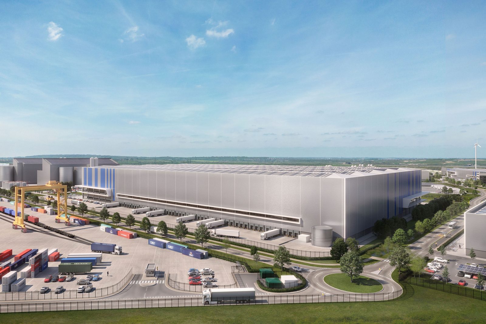
Contextually accurate CGIs for design and access statements, committee presentations and consultation material - honest about scale, massing and materiality.
05
Massing & design studies
Early-stage massing and options studies that help your design team and consultees resolve height, footprint and layout before submission.
06
Consultation material
Clear, credible imagery for pre-application engagement and public consultation - the visuals that build confidence with communities and officers.
AVR capability
AVR0 to AVR3 - the full fidelity range.
We work to the Landscape Institute’s Accurate Visual Representation levels, matching fidelity to what each viewpoint and application actually requires.
AVR 0
Location & size
Position and scale of the proposal shown in context - the baseline for early assessment.
AVR 1
+ Massing
Height, form and overall massing added, communicating the building envelope accurately.
AVR 2
+ Description of materials
Materiality and detail introduced so the character of the proposal reads correctly.
AVR 3
Full photorealism
Fully rendered, wireline-verified views suitable for LVIA submission and public inquiry.
Built to withstand scrutiny
Every verified view is underpinned by survey data and a documented methodology. Planning authorities and public inquiry panels have tested our approach - it holds because it is built correctly from the outset.

Methodology that holds up
Verifiable data, not approximation.
Our AVR process starts with accurate survey information and GPS-coordinated photography, tied to a documented methodology at every step. The result is imagery an inspector can trust and an objector cannot easily undermine.
- Survey-aligned camera positions and focal lengths
- Recorded date, time and conditions for each view
- Wireline verification against the approved model
- Methodology document supplied with every submission
Complexity is our strength
Sensitive contexts, handled properly.
Green Belt edges, AONB fringes, conservation areas and prominent frontages are where accurate visualisation matters most - and where we do our best work. We help you demonstrate impact honestly and make the case for consent with confidence.
- Landscape and visual impact (LVIA) support
- Townscape and heritage viewpoint studies
- Cumulative and phased-development assessment
How planning work runs
From brief to approval.
A process designed around your planning timeline, not our production schedule. For AVR work, survey and photography requirements are coordinated from day one so nothing holds up the submission.
See our full process →01
Brief & scope
We establish the planning stage, viewpoints and required AVR levels, and align on deliverables and timeline.
02
Survey & photography
GPS-coordinated viewpoint photography and survey data collected to the standard the application demands, documented throughout.
03
Production & verification
Verified views produced to the agreed fidelity, wireline-checked against the model, with review stages built in.
04
Delivery & support
Final outputs and methodology delivered. We support the submission, respond to authority queries and produce additional views if requested.
Who we work with
Developers, consultants and architects.
We work directly for developers commissioning planning imagery, alongside planning consultants who specify and coordinate AVR requirements, and as a technical CGI partner to architecture practices on complex applications. Direct instruction or subcontract - both are familiar ground.
In their words
Working on an industrial or logistics scheme?
It’s the sector we know best. See our dedicated industrial & logistics page for how we handle verified views and planning imagery for distribution, big-box and logistics parks.
Common questions
Planning questions, answered.
Do I need verified views (AVRs)?
If your imagery is going into a planning application in a sensitive or contested context, very likely yes - authorities and inspectors expect accurate, verifiable representations. If it’s purely for marketing, usually not.
If you’re unsure, tell us the situation and we’ll advise honestly - we won’t sell you an AVR you don’t need.
Can I just use an AI-generated image instead?
For quick internal exploration, AI images can be useful - but something that looks convincing isn’t the same as something that’s verified. For planning, imagery has to be accurate and defensible under scrutiny, and an AI render that “looks right” can’t stand up to that. We’d rather give you something genuinely right than merely plausible.
What’s the difference between planning and marketing images?
Planning images prioritise accuracy and evidence - showing a scheme honestly, in verifiable context, to help an authority assess it. Marketing images prioritise persuasion. The underlying craft is the same; the emphasis differs, and many schemes need both.
Why don’t the materials look exactly like the architect’s elevations?
An elevation shows a material flat-on under one even light. In a 3D view it’s seen in real light and at an angle, so reflections, sheen and shadow change how it reads - a single cladding or brick can look lighter or more reflective across a scene, exactly as it would on the finished building. That realism is deliberate, not an error.
If you’d prefer a material tuned closer to how it appears on your elevation, just tell us and we’ll adjust it - realism is our default, but the look is always something we can dial in with you.
Start a conversation
Have a planning application in progress?
Send us the brief - or just the constraints you’re working with - and we’ll tell you exactly what’s needed and what it will cost.